

Civic Insight builds and maintains tools that make complex data easier to access, understand, and use. Many tools are developed in partnership with organizations and tailored to their specific needs and audiences, such as public-facing dashboards and multi-layered interactive maps.
Our Tools and Data
-
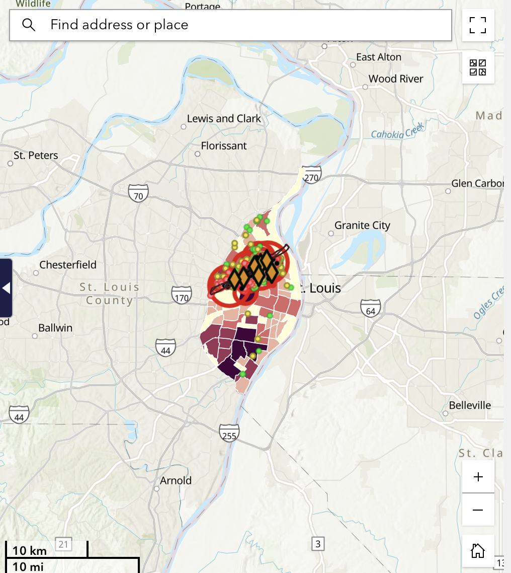
St. Louis City Tornado Recovery
The St. Louis City Tornado Recovery tool is meant to aid in the long term recovery of St. Louis City after the destruction caused by the May 16th, 2025 tornado. Users can explore the socioeconomic landscape of impacted neighborhoods, the potential needs of the communities, and damage assessments conducted on dwellings by the American Red Cross.
From our systems alignment to geospatial mapping and StatSnacks, our diverse range of tools help leaders, practitioners, and community members move from raw information to clear insight.
Services and Tools in Action
-

Data Readiness and Systems Alignment
We connect information from multiple programs, partners, and systems. We focus on tools and processes your team can sustain over time, so data becomes an everyday asset rather than a one-time project.
Who it’s for
Foundations, public agencies, and nonprofit collaboratives that need secure data workflows to support evaluation, learning, and decision-making across initiatives.
-

Dashboards and Scorecards
Civic Insight designs custom dashboards and scorecards that give leaders real-time visibility into the indicators that matter most. These tools may track outcomes, equity measures, or operational metrics, and can be tailored for staff, boards, funders, the public or other audiences. By providing a clear snapshot of performance, dashboards and scorecards help organizations adjust strategies and communicate progress with confidence.
Who it’s for
Organizations that want an ongoing, visual way to monitor key metrics—without relying on one-off reports or manual spreadsheets.
-

Geospatial StoryMaps and Mapping Tools
We build interactive mapping tools and story maps that show how opportunities and outcomes vary across neighborhoods or regions. These tools bring together geospatial analysis, narrative, and visuals to make spatial patterns easier to understand and act upon, supporting both internal planning and public engagement.
Who it’s for
Partners whose work is closely tied to place—such as community development organizations, housing initiatives, workforce collaboratives, and local governments.
-

StatSnacks
StatSnacks are Civic Insight’s bite-sized looks at emerging data and trends. Each post highlights a single question, pattern, or insight we’re seeing in the data—often drawn from work with partners or our broader research. Designed to be read in a few minutes, StatSnacks are a simple way for leaders and community members across the country to stay informed and spark deeper conversations about the issues that shape their communities.
Who it’s for
Anyone and everyone who is hungry to learn more!
If you’d like to explore how Civic Insight can support your goals and develop practical tools, contact us to get the conversation started.